Property Record
847 Lain Ave, Bowling Green, KY 42101


NEARBY LISTINGS FOR SALE OR LEASE
Property Detail
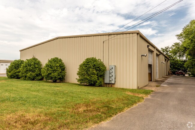
847 Lain Ave
040C-05-013F
Mid Town Plaza Subdivision
Industrialgeneral
Warren
X
Kentucky
21227C0306E
0.74 AC
2025
Downtown Bowling Green
2025
Other Market Areas
010500
Bowling Green, KY
8,280 SF
DEMOGRAPHICS near 847 Lain Ave
1 Mile
3 Mile
5 Mile
2024 Total Population
9,727
53,541
91,451
2029 Population
10,696
58,786
100,609
Pop Growth 2024-2029
+ 9.96%
+ 9.80%
+ 10.01%
Average Age
36
35
35
2024 Total Households
4,105
21,080
35,820
HH Growth 2024-2029
+ 10.99%
+ 10.65%
+ 10.71%
Median Household Inc
$36,182
$41,985
$47,914
Avg Household Size
2.00
2.20
2.30
2024 Avg HH Vehicles
2.00
2.00
2.00
Median Home Value
$217,155
$209,215
$215,029
Median Year Built
1963
1983
1989
Nearby Places
Map Layers
Map Styles
 Street
 Aerial
- Restaurants
- Banks
- Shops
- Fitness
- Groceries
SALE & LEASE HISTORY
LISTING DATE
SALE/LEASE

Mar 20, 2018
For Sale
Aug 22, 2017
For Lease
Nearby Properties
Address
Land Use
TOTAL SIZE
Lot Size
Zoning
Address
Land Use
TOTAL SIZE
Lot Size
Zoning
26,586 SF
17.19 AC
Address
Land Use
TOTAL SIZE
Lot Size
Zoning
7,399 SF
57.89 AC
Address
Land Use
TOTAL SIZE
Lot Size
Zoning
15,440 SF
16.52 AC
Address
Land Use
TOTAL SIZE
Lot Size
Zoning
117,551 SF
5.06 AC
Address
Land Use
TOTAL SIZE
Lot Size
Zoning
12.29 AC
Address
Land Use
TOTAL SIZE
Lot Size
Zoning
261,579 SF
17.71 AC
Address
Land Use
TOTAL SIZE
Lot Size
Zoning
Address
Land Use
TOTAL SIZE
Lot Size
Zoning
150,327 SF
2.54 AC
Address
Land Use
TOTAL SIZE
Lot Size
Zoning
175,830 SF
8 AC
Address
Land Use
TOTAL SIZE
Lot Size
Zoning
39,504 SF
19.74 AC
Address
Land Use
TOTAL SIZE
Lot Size
Zoning
36,984 SF
7.26 AC
Address
Land Use
TOTAL SIZE
Lot Size
Zoning
105,987 SF
7.98 AC
Address
Land Use
TOTAL SIZE
Lot Size
Zoning
93,730 SF
4.05 AC
Address
Land Use
TOTAL SIZE
Lot Size
Zoning
100,193 SF
9.82 AC
Address
Land Use
TOTAL SIZE
Lot Size
Zoning
40.04 AC
Address
Land Use
TOTAL SIZE
Lot Size
Zoning
19.61 AC
Address
Land Use
TOTAL SIZE
Lot Size
Zoning
142,199 SF
12.95 AC
Address
Land Use
TOTAL SIZE
Lot Size
Zoning
192,994 SF
22.55 AC
Address
Land Use
TOTAL SIZE
Lot Size
Zoning
214,273 SF
26.97 AC
Address
Land Use
TOTAL SIZE
Lot Size
Zoning
6.55 AC
Address
Land Use
TOTAL SIZE
Lot Size
Zoning
54.74 AC
Address
Land Use
TOTAL SIZE
Lot Size
Zoning
96,696 SF
9.69 AC
Address
Land Use
TOTAL SIZE
Lot Size
Zoning
208,264 SF
26.05 AC
Address
Land Use
TOTAL SIZE
Lot Size
Zoning
Address
Land Use
TOTAL SIZE
Lot Size
Zoning
Address
Land Use
TOTAL SIZE
Lot Size
Zoning
Address
Land Use
TOTAL SIZE
Lot Size
Zoning
Address
Land Use
TOTAL SIZE
Lot Size
Zoning
17,010 SF
9.64 AC
Address
Land Use
TOTAL SIZE
Lot Size
Zoning
2,946 SF
3.59 AC
Address
Land Use
TOTAL SIZE
Lot Size
Zoning
15,392 SF
8.50 AC
The World's #1 Commercial Real Estate Marketplace
Connect with us
© 2026 CoStar Group
The information above has been obtained from sources believed reliable. While we do not doubt its accuracy we have not verified it and make no guarantee, warranty or representation about it. It is your responsibility to independently confirm its accuracy and completeness. Any projections, opinions, assumptions, or estimates used are for example only and do not represent the current or future performance of the property. The value of this transaction to you depends on tax and other factors which should be evaluated by your tax, financial, and legal advisors. You and your advisors should conduct a careful, independent investigation of the property to determine to your satisfaction the suitability of the property for your needs.